
Photo Services

Index of
Photo Services
Target
Scheduling
Photo Details
Final Outcome
Aerial Photography /..(noun)...The taking of photographs of the ground from an elevated position. Cameras may be hand held or mounted, and photographs may be taken by a photographer, triggered remotely or triggered automatically. Platforms for aerial photography include fixed-wing aircraft, helicopters, balloons, blimps and dirigibles, rockets, kites, parachutes, ...see Ryerson Aircraft.
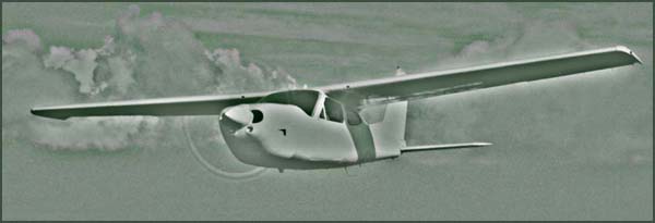
Ryerson Aircraft, Inc./..(pr. noun)... ..Aerial platform operation based at Milwaukee's Mitchell International Airport since 1981. Full time, year-round photo flights conducted in fixed-wing aircraft (model shown above). Here is our specialty:
1. Immediate dispatch to your location. Next Available Good Weather : All photo flights are conducted as soon as we receive request, and suitable weather, enroute and at the site, exists. As such, lead times, while useful, are not required.
2. Shoot location with (Pentax SLR Digital) camera. If project requires the use of film, we can use our Pentax medium format cameras. However, excellent prints on photographic paper can be made with digital files.
3. Land and edit the shots. Post proofs to website. Often, this is done on the same day. using Adobe Photoshop, we can optimize all images, and write to a variety of formats, like tiff, jpeg, pdf, etc., and in a file size to suit your needs. Other editing options are available, such as logos, text, or property lines.
4. Ship CD or DVD to your location, with all web and full size files. You have full use rights, and may use these digital files to have your own prints made, to use as e-mail attachments, or web site images.
If any of this looks as though it might work for you, send us an e-mail, or better, give us a call. (links on homepage)
Target Location
Often, a verbal discription is all that's needed. Addresses are helpful, better is a physical description of the location, ie... southwest corner of Main & 1st Sts, plus any nearby landmarks.
Very useful: a link or image from a satellite image server. If using Google Earth, send the snapshot of 3d view. We'll accept latitude and longitude coordinates, as well.
Use the following link to connect to Flash Earth, a collection of satelite images. By entering a common description in the search box, we can pinpoint the subject.
Flash Earth - Satellite Images
When using Flash Earth, use the select buttons in upper left corner to toggle between image servers, some with street labels. Not all services are available at each location.
Subject
We'll need a description of the primary subject, be it a single building or residence, office structure, retail store or commercial district, vacant land, special event, etc.
Click here for further examples of subject types.
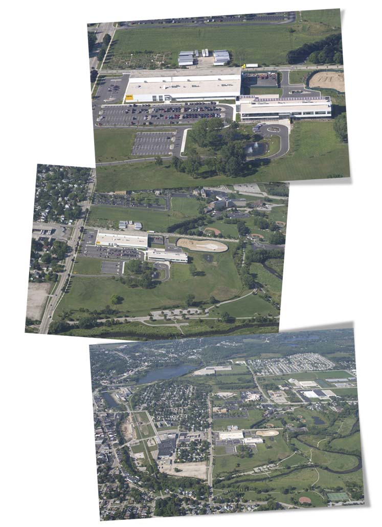
Scope
Once the target is determined, you'll need to specify how much of the surrounding areas, in relation to the target you want shown
Premises, or Close-up,
subject is full frame
Vicinity, or neighborhood
coverage
View toward horizon, in
increments of a mile
from the subject location
Distance
Distance to site is measured from Milwaukee's Mitchell Airport (kMKE).
Mileage distance will apply as part of the photo project fee.

Multiple Sites
Flight fees may be reduced with multiple locations, if conditions allow photography
at all the sights on the same flight.
We measure and rate the furthest site, any interlying sites will be
charged a lesser rate,
regardless of distance flown from homebase.

In this example, we rate the flight to Green Bay, with the added mileage charge beyond the first 35 miles, and the locations in Manitowoc and Oshkosh will be added at less than the full rate per site.
Final Outcome of Project
It helps to know from the outset what you have in mind for a final project, we can then suggest and plan for methods and formats that insure best results.
Our strategies change depending on the need for photo prints, electronic files, banners, posters, film or transparancies.
We will also attempt to be flexible in acquiring images. It is possible to create good photo prints from digital exposures, or good digital files from film and printed material. This does allow for a good degree of flexibility after images are acquired .
Lead Times
Next Available Good Weather : All photo flights are conducted as soon as we receive request, and suitable weather, enroute and at the site, exists. As such, no real lead times are required.
You can plan in advance, a specific date and time, or schedule shots, as in weekly, monthly, quarterly, or yearly.
Notices
The FAA publishes notices pertaining to airspace around sporting events, airshows, natural disasters or Presidential movements. Our company must observe these restrictions, as such, we might not be able to complete a photo flight, even if conditions are otherwise optimal.
On our homepage, there is a link to the Restrictions page where you can get current information on most restricted airspace. Click here to jump to that overview.
Also on the homepage, a bulletin board for local weather, and other information pertinent to photo flights
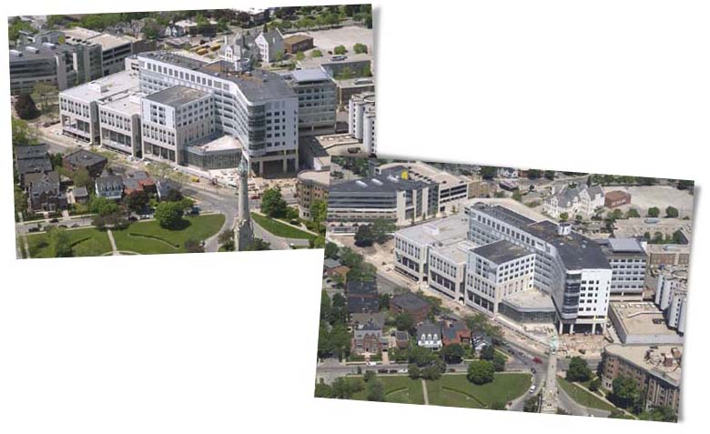
Time of Day
An important consideration is the direction the subject faces, and the existing light at the time of the shoot.
Here are two shots of the same complex, both looking to the northwest
Taken after noon
Taken in the morning
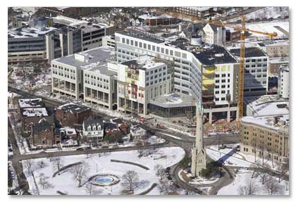
Seasonal Concerns
In the Upper Midwest, late April through June is a good time for property shots; lush and very green. In July and August it's possible to have a browning of the fields and grass. Autumn colors are nice, but do change the tone of photographs.
Campare this shot, taken in February, to the same site photos above.
Sky Conditions
Any time you shoot photos toward a bright sun (early morning, late afternoon, or just about any view to the south), the foreground of the shot is in dark shadows. On property survey shots, or anytime this is the only good angle, it's best to shoot with a high, thin overcast sky. It's just as bright, and easier to detet detail.
Compare these two shots, the one to the left
taken on a very sunny day, ...

... to this one taken
under thin overcast conditions.
Actually, a high, thin overcast sky condition is
good for shooting in any direction.
Compare this with those above, notice there is no
shadowing
anywhere in the shot
Of Special Concern: Many wide-area shots
have been ruined by a broken deck
of clouds, specifically,
the cloud shadows.

Camera Orientation
There are two types of aerial camera orientation: oblique and vertical.

Vertical: Camera is pointed straight down,
the center of the frame is the principal point.
Oblique: Camera at an angle between
vertical and up to the horizon.
To the right is a "low" oblique
of the vertical above.
The shot to the left is considered
a high oblique, since it shows horizon.
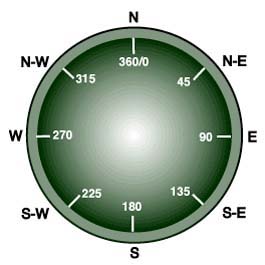
Compass Points
Along with Northeast, Northwest,
Southwest and Southeast,
they are the basic directions of view.
The camera direction of view is the direction the camera is pointed. So, a north view is pointed north.
Number of Shots
Along with the distance traveled to the photo site, the number of shots taken to complete the assignment is factored into the final cost.
For most locations, good coverage is obtained with 20 to 20 frames.
Each project is different, we'll work with you to determine the proper amount.
Digital Files
Any of our photo shots can be taken in, or converted to digital format.
We can send you the files as an e-mail attachment, make them downloadable from our website, or write them as permanent files to a CD or DVD.
We can have good photo prints made from any of the digital files we shoot, before or after image manipulation.
- Types of Digital Files
- Jpeg - best used for computer display, e-mail attachemnts.
- Tiff - better color, used for printing
- PSD - Photoshop, best for manipulation
- PNG - common file for digital cameras, page layouts
- Raw - high end digital camera file
- PDF - portable document file
- GIF - used for computer display, lettering and solid colors
- PICT - used for computer display, simple logos or fewer colors
- Digital Files Sizes and Dimensions
Dimension approximate Jpeg Size Displayed Size 250 dpi Print 100 dpi Print 800x600 .5 Megapixels 200K 1.4 Mb 3.2 x 2.4 " 8 x 6 " 1200x800 1 Megapixel 350K 2.7 Mb 4.8 x 3.2 ' 12 x 8 " 1500x1000 1.5 Megapixel 560K 4.3 Mb 6 x 4 " 15 x 10 " 3000x2000 6 Megapixels 1.5 Mb 17 Mb 12 x 8 " 30 x 20 " 3800x2500 9 Megapixels 2.2 Mb 27 Mb 15 x 10 " 52 x 35 "
Screen Resolution & File Size: When displaying a photo on a computer screen, the amount of the photo shown is a function of the image size and the screen resolution of the monitor.
If this were a 1200 pixel wide image,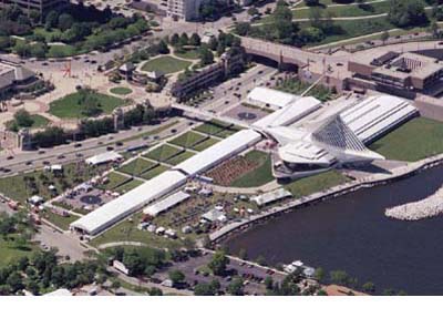
It would fully display on a monitor set to 1400 pixels.
Only a portion of the picture would show on a monitor resolution of 800 pixels.
Jpegs and Gifs are good choices for cross-platform versatility. They are highly compressable, and are quick and practical to send and display. This compression is achieved by using a smaller color palete, so quality is sometimes degraded.
Tiffs are a better file to make prints from. They use a larger color spectrum, and the image does not degrade with repeated use of the file. A resolution of 250 dpi should be the target for good print files.
File Preparation
Our digital files are captured in the raw mode, for optimal post-flight editing and manipulation.
We take each file and adjust for contreast, brightness and color balance. If you do not have editing software on your computer, we
caan help adjust the necessary files to suit your needs.
Our basic package includes each digital file written into several formats and file sizes.
High Resolution Files - to 3000 pixels wide, Tiff and Jpeg.
JPeg files - to 1500 pixels.
Complete Web Browser gallery viewer.
We can add any user supplied text, graphics, or logos.
All files may be used as E-mail attachments.
All files are sold outright, with no use limitations.
Specify if you need other thatn Jpegs saved with embedded profile of Adobe RGB 1998.
Shipping
Shipping charges are extra.
At a minimum, all CDs, DVDs or photo prints can be mailed, using regular, Express, or Priority methods.
Other overnight services are available, if preferred.
If time is critical, we can upload any full-sized digital files to our web server, where you can download in minutes any of our finished digital files.
Thanks!
..don't forget ! ...
Once the project parameters are established, we must check for weather, airspace restrictions, maintenence, and other safety of flight issues before we may proceed.